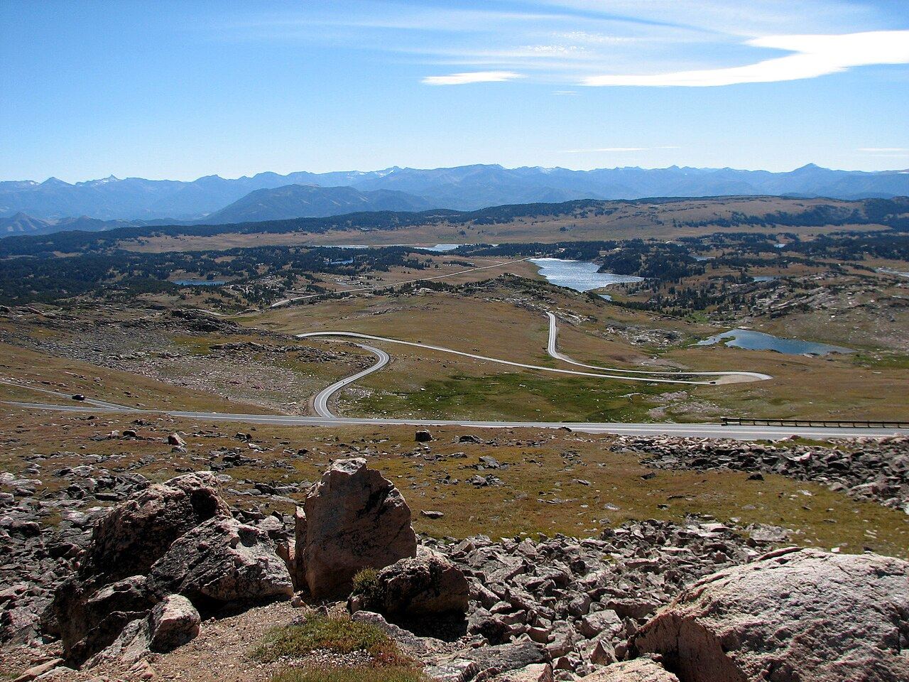
Beartooth Highway (US-212)
Switchbacks to almost 3,350 meters, snow walls in June and the back door to Yellowstone.
Photo: WizardFusion · Public domain
- Distance
- 110 km · 68 mi
- Highest point
- 3,337 m · 10,947 ft
- Difficulty
- Moderate
- Time needed
- 2–3 hours with stops
- Best season
- Late May to mid-October
Beartooth Highway guide: Red Lodge to Yellowstone on US-212, Beartooth Pass, switchbacks, opening dates, weather, fuel and the Chief Joseph Scenic Byway.
From the old mining town of Red Lodge, Montana, the Beartooth Highway climbs a wall of switchbacks onto a high plateau of tundra, alpine lakes and snowfields. At Beartooth Pass it reaches 3,337 meters, the highest highway in Wyoming and Montana. Journalist Charles Kuralt called it “the most beautiful drive in America”.
The road then winds past dozens of lakes and descends through forests to Cooke City and the northeast entrance of Yellowstone, right next to the wildlife-rich Lamar Valley. Combine it with the Chief Joseph Scenic Byway for one of the best loops in the West.
Stops along the way
-
1
Red Lodge, Montana
A charming mountain town with a historic main street. Fill up and grab a coffee.
-
2
Rock Creek Vista Point
Pull over to look back at the switchbacks you have just climbed.
-
3
Beartooth Pass (10,947 ft)
The highest point of the ride, with snow fields even in July and views over the Absaroka Range.
-
4
Top of the World store
A small store and gas station in the middle of the high plateau.
-
5
Cooke City
An old mining village and the last stop before Yellowstone.
-
6
Yellowstone Northeast Entrance
The quiet entrance to Yellowstone, leading straight into the Lamar Valley.
Good to know
- The highway is usually open from late May to mid-October, depending on snow.
- Pack warm layers: it can be near freezing at the top even in summer.
- Afternoon thunderstorms are common; ride in the morning.
- Watch for wildlife and gravel on the curves.
Photo gallery
No reviews yet. Been here? Be the first to share your tips!


Traveler reviews